Showing posts with label Schneeberg. Show all posts

Monday, January 4, 2016

Scrambling day at Schneeberg

The weather was pretty foggy


Higher up on the approach, Oberer Herminensteig barely visible on the background


We were hoping to be able to get above the clouds, but instead we got between two layers of clouds. It was still quite pretty.


 Bürkle-Steig, a 400-meter alpine route. 


Krumme Ries on the left side of the buttress looks pretty good for skiing 


Our route of the day was Novembergrat, a 500-meter ridge. With the approach, it's about 1100 vertical meters. 


 It was just easy scrambling, but a nice way to get used to NE-side of Schneeberg. 


 Breite Ries


 More scrambling


 On Hochplateau! It's not the summit of Schneeberg, but high enough for us.


Not sure if I'm taking a selfie or peeing... probably doing both


The top was quite foggy


 A map and a compass are good to have.


 There are some marked paths, but I wouldn't count on those in the winter


 We decided to come down via Herminensteig. It's a similar arete to Novembergrat.


The good thing about aretes is that you don't get lost


 Almost like in the Dolomites


 A lot of down scrambling. It's easy and fun, but it's good to remember that there are a lot of places where you simply cannot fall. It was just a day before someone died at Schneeberg after falling 150 meters.


 The north face of the buttress. I'm pretty sure you can find some adventurous climbing here.
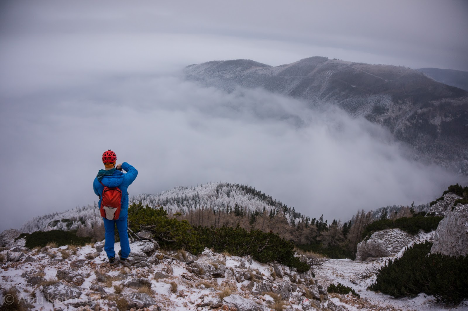


Between the clouds again. Time to take some more photos.


 Frozen trees


The sea of fog


Note to self: If you want to have a white Christmas, Schneeberg is a safer bet than southern Finland


Back at the car just before it got dark. No need for headlamps. 

Friday, June 12, 2015

Stadlwand

Stadlwand is one of the biggest limestone walls in Höllental. It is located on the southern part of Schneeberg, but doesn’t continue to the top of the mountain. The top of the wall is at 1407 meters.

There are a plenty of good-looking routes on the wall, but we decided to climb one of the easiest and longest ones. We started with the direct start to Richterweg, then climbed Richterweg and continued to the top via Stadlwandgrat. This continuous buttress/ridge is altogether about 800 meters (25 pitches) long and the hardest parts are around UIAA 5. Nothing too difficult, but it's still a lot of climbing. 


 Racking up the gear…40 meters of rope, 40 draws, 4 cams, 2 nuts, 2 tri-cams, 5 slings...


 The approach takes an hour


 Richterweg


 Advanced top roping skills


 The route follows a buttress, but the direct start is not too obvious. The directions in the guidebook are quite detailed, and there was even a metal wire to show the starting point. Still, there was a Hungarian couple that was about to do the same route as we but wasn't sure where to start. We were pretty sure where the route would go, and started to climb. The other party was still not convinced and decided to bail even before starting the route. 


Higher up on Richterweg


 Stadlwandplatte on the left side of the buttress looks very good


 I run out of ropemans but tiblocs works as well for simul climbing. They are less safe but better than nothing.


Richterweg turns into Stadlwandgrat


 Very nice scrambling


 Anu on the last pitch of Stadlwandgrat. It’s nice to have routes like this only 85 km from home. 


 We simul climbed the route in 5 hours, stopping three times to gear up. 40 draws was a bit overkill compared to 4 cams… For some reason I thought that there would be more bolts. Next time (for simul climbing) I would take 30 draws (10 x 60cm), 10 extra biners, 8 cams, and 10 slings (120cm), and also a few 200cm slings. Nuts and tricams are slow to use and don’t work with ropemans so I wouldn’t take those. A 30-meter rope would have been better for simul climbing, but we decided to take 40-meter rope in case we would need to rappel.


 Misfortune of the day: They don’t sell beer at the top! The descent starts from here, following an easy path through the forest.


 The never-ending ridge seen from the walk down


 It was a very hot day, +30 degrees and a south face. I run out of water on the last pitches of Stadlwandgrat, but luckily we found some water on the way down.


 A river in Höllental, right next to the parking


 This felt pretty good


Yet another kick-ass day in eastern Alps. Prost!

Saturday, November 1, 2014

Schneeberg

Schneeberg (2076 m) is the highest mountain in Lower Austria and together with Rax (2007 m) considered the Viennese Hausberge (local mountains). Schneeberg is the mountain that seems to always rule the view when driving south from Vienna. If the weather is clear, Schneeberg is visible even from Vienna. 

We are not really mountain climbers, but what I was interested in the most were the 450 meter long sport routes that are on the west side of the mountain. However, Schneeberg is quite big and it’s not really obvious where we should go. And we didn’t even know for sure where we would like to go. Maybe to the top? Or at least above the clouds.

Most of the pictures of Schneeberg were taken from Puchberg am Schneeberg so we decided to go there at first. There actually is a train(!) from Puchberg to (almost) top of Schneeberg and for us, it sounded like a nice way to cheat our way to the summit.

However, 70 € for two was a bit too salty price. So, instead of train-mountaineering we bought a good map, and drove as high as we could with the car.


 Anu spotted a pizzeria at Hintern Federn, so here we go again... It was already 1:30 PM so I was a bit skeptical about our mountain climbing plans. However, the pizzeria was very close to a ski resort and the lift was running. We didn’t know where it would take us, but at least we would get 500 meters higher.


 Hydrating with red wine makes mountain climbing a bit more fun.


 Holy moly, snow


 Hiking makes you thirsty. Nice crags on the background. Probably not worth the hike though.


 No idea what the scale is, but these look nice.


 Smoky crags


 Ok, this is more fun than boulder hunting.


 Taking photos of snow made me feel like a Japanese tourist. 


Afternoon pizza & beer = no summit. Our high point was probably somewhere at 1500 - 1700 meters. We also missed those 450-meter sport routes, which happen to be located on the other side of the mountain. Still, we weren't too disappointed. 


After all, we got this


 This is the top of the snowy crags we saw before


 Clouds


 65 km of driving from Mödling, helt okej!


 Sun goes down, it's time to move


 Back in the foggy forest


 ISO 12800 gives a nice Blair Witch effect


 It was pretty foggy, but not a problem as long as there was a bit of sunlight


30 minutes later it was a bit different... with a headlamp you could see only about 1 or 2 meters. We found a bar on the top of the ski resort (closed, too bad), but the lift 50 meters away was impossible to find. Not that it would have been running any more, but there was a road close by and that might be the easiest way down. 

After wandering around for a while we ended up at a cabin. There were some lift workers who were just about to drive down. They offered to take us down so unfortunately we skipped the adventurous part of the day. A few minutes later we were already at our car and driving back to Mödling.  A nice way to spend a rainy day, and a not too bad alternative for crag hunting!